
Elevation Certificate Support for Flood Zone Decisions
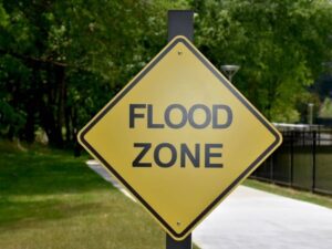
Flood zones raise hard questions for anyone buying near water. An elevation certificate answers many of them with plain numbers. The document records how high a building sits compared to the local flood level, and it comes from a licensed surveyor who measures the structure directly. For a buyer, that single form settles worries a listing photo or a flood map alone leaves open. It shows where the property really stands. And knowing that early stops a purchase from turning into a costly guess.
Using an Elevation Certificate Before Buying Flood Zone Property
Due diligence is the window where a buyer still has room to walk away. Pulling an elevation certificate during that window puts real flood facts on the table before money changes hands. If the numbers look bad, the buyer can renegotiate, ask for repairs or step back without penalty. That kind of freedom disappears the day the sale closes.
Lenders often drive the request. A bank weighing a mortgage on flood zone property may ask for elevation proof before it approves the loan. Handing over a current certificate answers that question fast and moves the approval along. When the paperwork stalls, so does the closing date.
The bigger payoff comes after the keys change hands. Owners who skip this step sometimes learn about a low floor or a rough flood rating months later, when a fix costs far more. Reading the certificate early spares them that shock. It lets a buyer decide with open eyes rather than hope for the best.
What Property Owners Should Review on an Elevation Certificate
An elevation certificate holds more than one number, and each part tells the owner something useful. Reading it well means knowing where to look. A few fields carry most of the weight for everyday choices.
Parts worth a close look include:
- The building location, which confirms the certificate matches the right structure on the right lot
- The measured floor elevations, which show how high the living space sits above the ground
- The flood zone reference, which ties the property to its spot on the local flood map
- The structure details, like the foundation type and any attached additions
- The surveyor signature and date, which prove the data is current and certified
Owners do not need to master every line to get value from the form. Matching the address, checking the elevation figures and confirming the zone reference cover the basics. If any of those look off or out of date, that is the signal to ask a professional for a closer read.
How Elevation Certificate Data Helps With Renovation Planning
Renovation plans on flood zone property come with extra rules, and elevation data helps a team work around them from the start. Contractors and designers need to know how high the existing structure sits before they sketch an addition or a raised floor. The certificate hands them that starting height without a fresh trip to the field.
Picture an owner who wants to add a room or rebuild after storm damage. Local rules may require the new work to reach a set height above the flood level. With the elevation figures already on paper, the builder designs to that mark on the first try. That saves redraws and stops the permit review from bouncing the plan back.
Early access to the numbers also shapes budget talks. A contractor who knows the floor height can price a raised foundation or flood vents before the work begins. Owners then weigh their choices against real limits instead of rough guesses.
Why Updated Elevation Information Matters for Older Properties
Older buildings often carry paperwork that no longer matches what stands on the lot today. A certificate from decades ago may predate an addition, a raised foundation or a change in the surrounding grade. When the record and the real structure disagree, decisions built on that record start to wobble.
Missing files cause the same trouble. Many older properties changed hands several times, and the original elevation paperwork can vanish along the way. A buyer or owner who needs proof of the current floor height has nothing to show a lender or reviewer. A new certificate closes that gap with accurate, up-to-date figures.
Accuracy matters most when other people rely on the document. Lenders, insurers and local offices treat old or unclear data with caution, and they may reject it outright. Current elevation information gives everyone a record they trust, which prevents an older property from stalling a sale or a permit.
Coordinating Flood Zone Decisions With Surveyors and Local Reviewers
Flood zone decisions pull in a lot of people at once. A licensed surveyor sits at the center of that group, because the certificate they produce becomes the record everyone else works from. When the surveyor numbers are clear, the whole exchange moves with less friction.
Each party leans on the same document for a different reason. A lender checks the floor height against loan rules. An agent points a buyer toward solid flood facts. An insurance contact reads the elevation to sort out coverage, and a contractor uses it to plan work that meets code. One certificate lines all of them up behind the same figures.
Local offices round out the group. Permit desks and floodplain reviewers want elevation data they can accept without a second request. A certificate that meets their format up front spares an owner the back-and-forth of resubmitting. The document ends up doing more than recording a height. It gives every party a single record to work from and trims the delays that come from mismatched paperwork.
Frequently Asked Questions
When should I request an elevation certificate before buying property?
Ask for one during due diligence if the property sits in or near a mapped flood zone. It also makes sense when a lender, agent or local reviewer asks for flood-related elevation records before the deal moves ahead.
Can an elevation certificate help with remodeling decisions?
Yes. The form supplies floor height and elevation details that help owners and builders understand flood-related rules early. That head start makes it easier to plan repairs, additions or improvements that meet local requirements.
Why might an older property need a new elevation certificate?
Older records sometimes go missing, read as unclear or fail to match the building as it stands now. A new certificate replaces that shaky paperwork with current figures a lender or reviewer can accept.
Who uses elevation certificate information during a property decision?
Buyers, homeowners, lenders, insurance contacts, agents, contractors and local reviewers all draw on the same figures. Each one reads the elevation data to weigh flood-related concerns from their own angle.
For a free land surveying quote, call us at (205) 291-4795 or send us a message by going here.
