
How Drone Surveying Helps Developers Compare Multiple Parcels Faster
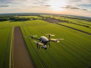
Picking the right piece of land is one of the biggest choices a developer makes. Get it wrong, and the costs show up later in grading, drainage, or a boundary fight. Drone surveying gives you a fast, clear look at several parcels before you commit. It helps you rank your options with real data instead of guesswork.
Most buyers start with a map and a hunch. That works until two sites look equal on paper but behave very differently on the ground. Aerial data closes that gap quickly. Below is how it works and what it can save you.
Why Developers Need Faster Parcel Evaluation Methods
Developers rarely look at just one site. You may have three, five, or ten parcels in play at once. Each one needs a fair look before you spend money on it.
Old methods are slow. A ground crew walking every lot takes time, and time costs money while you wait. When you have several sites to check, those days add up fast. A slow review can push you past a deadline or let another buyer move first.
Speed also protects your budget. The sooner you rule out a bad parcel, the less you spend chasing it. Fast, early data lets you focus your money on the sites worth pursuing. That is where drone surveying earns its place.
Using Drone Surveys to Compare Multiple Sites
A drone survey uses a small aircraft to fly over a property and collect images and measurements. The result is a detailed map of the land, its shape, and its features. You get this data in a fraction of the time a full ground survey takes.
The real value shows up when you line up several parcels side by side. Each site gets the same type of data, gathered the same way. That lets you compare them evenly instead of guessing which one is better. You can look at slope, tree cover, and open space across every option at once.
This kind of review helps you sort your choices early. You can see which parcels are mostly flat and buildable and which ones hide steep areas or wet ground. You can also spot access points and rough boundaries. A clear comparison like this makes the next steps far easier.
How Aerial Data Reveals Existing Parcel Conditions
A photo from the road tells you very little about a property. Aerial data tells you much more. From above, a drone captures the full shape of the land and what sits on it.
Here are common conditions drone data can reveal:
- Slopes, high spots, and low spots that affect grading
- Standing water, ponds, or signs of poor drainage
- Tree cover and cleared areas
- Existing structures, roads, and driveways
- Rough locations of fences and property lines
- Signs of erosion or unstable soil
This view helps you catch problems before they become surprises. A parcel that looks simple might have a wet corner that limits where you can build. Another might have a steep grade that raises your dirt-moving costs. Seeing these things early changes how you value each site.
Supporting Development Decisions With Accurate Site Data
Good decisions need good data. Drone surveying gives you measurements you can trust, not rough guesses. That accuracy carries through the whole planning process.
Your engineers and designers can use this data right away. They can test different layouts, check where water will flow, and estimate grading needs. This early planning helps you see if a site fits your project at all. It also gives you a clearer view of what each parcel will cost to develop.
Accurate site data also helps you talk to lenders and partners. Numbers backed by a real survey carry more weight than a hopeful estimate. You can show why one parcel is a stronger buy than another. That kind of proof builds trust and speeds up approvals.
Reducing Due Diligence Risks Before Land Acquisition
Due diligence is the homework you do before you buy. Skip it, and you may inherit problems that cost far more than the land itself. Drone surveying strengthens this step by giving you facts early.
With aerial data, you can flag risks before closing. You might find a possible drainage issue, an access problem, or a boundary that does not match the listing. Catching these things early gives you room to negotiate or walk away. That choice is much cheaper before you own the land than after.
Some issues still need a licensed surveyor’s full review. Legal boundary lines, easements, and title matters can vary by property, county, and lender. A drone survey helps you narrow your list and ask better questions. Always confirm exact survey needs early when your timing, closing, or permits depend on the results.
Frequently Asked Questions
Is a drone survey as accurate as a ground survey?
Drone surveys are highly accurate for mapping land shape, slope, and surface features. They are excellent for comparing sites and planning early work. For legal boundary lines and title matters, a licensed surveyor still confirms the details on the ground. The two methods work best together.
How much faster is drone surveying than traditional methods?
A drone can cover a large parcel in hours instead of days. That speed grows when you review several sites at once. You get matching data for every parcel much sooner. This helps you make decisions while your options are still open.
Can drone data replace a full boundary survey?
No, drone data does not replace a legal boundary survey. It gives you a strong early picture of a site and its rough lines. A licensed surveyor still sets and confirms the true property corners. Use drone data to screen sites, then order a full survey on the ones you want.
For a free land surveying quote, call us at (205) 291-4795 or send us a message by going here.
Posted in Drone lidar mapping | Tagged Drone lidar mapping
