
Why Land Surveying Should Come Before Buying Land Near Road Improvements
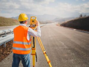
A road widening plan can take a strip off the front of a lot you haven’t even closed on yet. Many buyers only learn this later, when a driveway permit gets denied or a setback line lands closer than they expected. Land surveying before you buy land shows where your boundary sits compared to current and proposed road lines, so you know what you’re really paying for.
Land surveying is the process of measuring and mapping a property’s boundaries, features, and the rights that affect it. Near a road project, that work helps buyers and developers answer three questions: how much land they’ll keep, how they’ll get in and out, and whether the site still works. Getting those answers during due diligence costs far less than fixing a surprise after closing.
Identify Proposed Right-of-Way Before Buying the Property
Right-of-way is land a public agency owns or controls for a road, sidewalk, drainage, or utilities. Road improvement projects often need more of it. A proposed right-of-way line shows where the agency may acquire land in the future, and it can sit well inside today’s property line.
A surveyor can research deeds, recorded plats, and available road plans, then show existing and proposed right-of-way on a drawing of the parcel. That lets you see which strip could be acquired and what sits inside it. Signs, parking spaces, trees, septic areas, or a well near the front of a lot can all fall inside that strip.
Don’t rely on a listing map or an online parcel viewer for this. Those tools are fine for a quick look, but they aren’t boundary surveys and can be off by several feet or more. Ask your surveyor to plot any proposed lines they can find and to note which details came from plans that may still change.
Review How Road Improvements Could Change Site Access
Access is often the biggest hidden risk. A road project can add a median, move a turn lane, close a driveway, or limit new curb cuts. Any of those changes can affect how customers, delivery trucks, or residents reach the property.
A survey drawing shows current driveways, curb lines, and the distance to nearby intersections. Place that next to the road plans and conflicts become easier to spot. Before you commit, confirm these points with your surveyor and the agency running the project:
- Whether existing driveways will stay, move, or close
- Whether a new median will block left turns in or out
- Whether any new access point will need a permit
- Whether access easements cross the property or a neighbor’s land
Driveway spacing rules and permit steps can vary by agency, road type, and project scope. Ask about them early. Those answers can change what a site is worth to you.
Check Whether the Remaining Land Still Fits Your Plans
Losing a strip of frontage can matter more than the acreage suggests. Setbacks are often measured from the property line or right-of-way line. If that line moves back, the buildable area can shrink with it.
A surveyor can calculate the area left after a proposed taking and show updated setback lines. A topographic survey adds ground elevations, slopes, and drainage paths. Land surveying for property development can help put those measurements into the larger planning picture, especially when a road project changes the usable portion of a parcel.
Test your plans against that updated picture. Check whether the building footprint, parking, septic area, and stormwater space still fit. If they don’t, you may need a new layout, a variance, or a different property, and it’s much better to learn that before closing.
Use Land Surveying to Verify Road Project Information
Road project documents change as designs move forward. Early concept maps may show rough lines, while later construction plans are more exact. A survey ties those plans to real ground conditions, so you aren’t guessing.
Surveyors locate boundary corners, measure physical features, and compare them to recorded data and available road plans. They can flag spots where a fence, building, or utility pole sits inside a proposed right-of-way. They can also show where utility or drainage easements overlap project areas.
Keep in mind what a surveyor does and doesn’t do. A surveyor maps and verifies information, but they don’t decide what an agency will acquire or pay. For questions about compensation or legal rights, talk with a real estate attorney and the project agency.
Resolve Survey Concerns During the Due Diligence Period
The due diligence period is your window to ask questions and walk away if needed. Order the survey as early as you can, since research, fieldwork, and drafting take time. Timelines can vary by property size, available records, and project scope.
Review the finished survey with your agent, attorney, lender, and title company. Title companies may list survey matters as exceptions, and some commercial lenders require an ALTA/NSPS Land Title Survey. If you find a problem, you may be able to renegotiate the price, extend the due diligence period, or ask the seller to address certain issues.
Keep a written list of every open item and who’s handling it. Get key answers in writing where you can. A clear record helps if questions come up after closing.
Frequently Asked Questions
What does a land surveyor check near a road improvement project?
A surveyor locates the property boundary and maps existing right-of-way, driveways, easements, and physical features. They can also plot proposed right-of-way lines from available road plans. This shows how much land could be affected and what sits inside that area. The results help you judge whether the property still fits your plans.
Can a road project take part of a property after I buy it?
Yes, public agencies can acquire land for road projects, and a sale doesn’t stop that process. The rules and compensation steps vary by agency and project. Knowing about proposed right-of-way before closing helps you price the property with clear eyes. A real estate attorney can explain your rights if a taking is likely.
Is an online parcel map enough to see the right-of-way?
No, parcel maps are useful for a quick look but aren’t precise boundary records. They can be off by several feet, and they often don’t show proposed road lines. A boundary survey ties the lines to real ground conditions. That accuracy matters when a few feet of frontage can change access or setbacks.
How long does a survey take before closing?
Timing depends on property size, available records, site conditions, and the surveyor’s schedule. Research on road plans and right-of-way can add time. Order the survey as soon as your contract is signed. That leaves room to review results and ask follow-up questions before your due diligence period ends.
Do I need an ALTA survey or a boundary survey?
It depends on the property type, your lender, and your title company. Many residential and small land purchases use a boundary survey. Commercial deals often call for an ALTA/NSPS Land Title Survey because it covers more title-related items. Confirm the required survey type with your lender and title company early.
For a free land surveying quote, call us at (205) 291-4795 or send us a message by going here.
Posted in land surveying, land surveyor | Tagged land surveying
